| Up to now during our trip every day was fine. Today our luck has changed: dark clowds and bad weather was not only in the forecast but all around us. We decided not to do any longer walk but to concentrate on the small ones which can be done quickly along Highway 6 towards the north. |
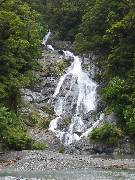
First stop after the Haast Pass is for a bush walk to the Fantail Falls. The name explains itself from the form of the fall. |
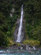
It's another 5km down the road and a five minutes walk to the 28m high Thunder Creek Falls. All activities today are along the Haast River until we will have reached Haast. |
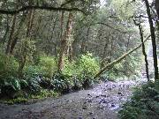
The Pleasant Flat hosts a pleasant return walk. There are panels giving an interesting insight to the special features of Mt. Arpiring Nat.Park. We can't enjoy the view on Mt.Hooker because of the weather. |
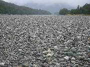
The Roaring Billy is the name of the waterfall when the stream with the same name and the Haast River meet. The enormous river bed is astonishing! It's a little longer walk, but you can see tree ferns a special feature of this walk. |
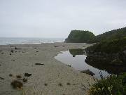
With arriving the coast to the Tasman Sea we are not far away from beaches. First stop was at Ship Creek. In the beginning of the last century a ship, which had wrecked at the shores of Australia, was brought here by the sea current. |
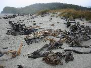
For me the todays remnants of the water movements are more interesting. They almost look a big sculpture, as if made from mankind with intention. |

Then we take a short walk along the beach to an observation point from were we can watch the delphins just off the coast. Inland there is a lake and bush hosting a great diversity of bird life and plants. |
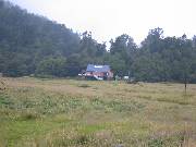
After a bit of drive further north we stopped at a salmon farm (just at the Paringa river). It serves as cafe and bistro and you can enjoy feeding the fish with fish pallets (isn't that irony?). |
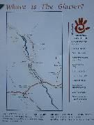
Last waypoint for today is one of the most famous attraction of NZ: the glaciers. The first one coming from the south which is accessible for the public is the Fox Glacier. |
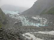
Viewing along the glacier from far away reveals the extension of the icy, creeping tongue of ice. |
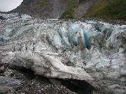
The terminal face of the glacier looks ugly because of all the dirt and rocks the ice carries with it. |

You get an impression of how impressivly big the ice once was when you take a closer looks at the valleys side walls: even high above the stone is smooth standing vertically up. |

A final look down from the glacier's face the valley it once covered. Today there is only dirt, stone and the melting water meandering through. |